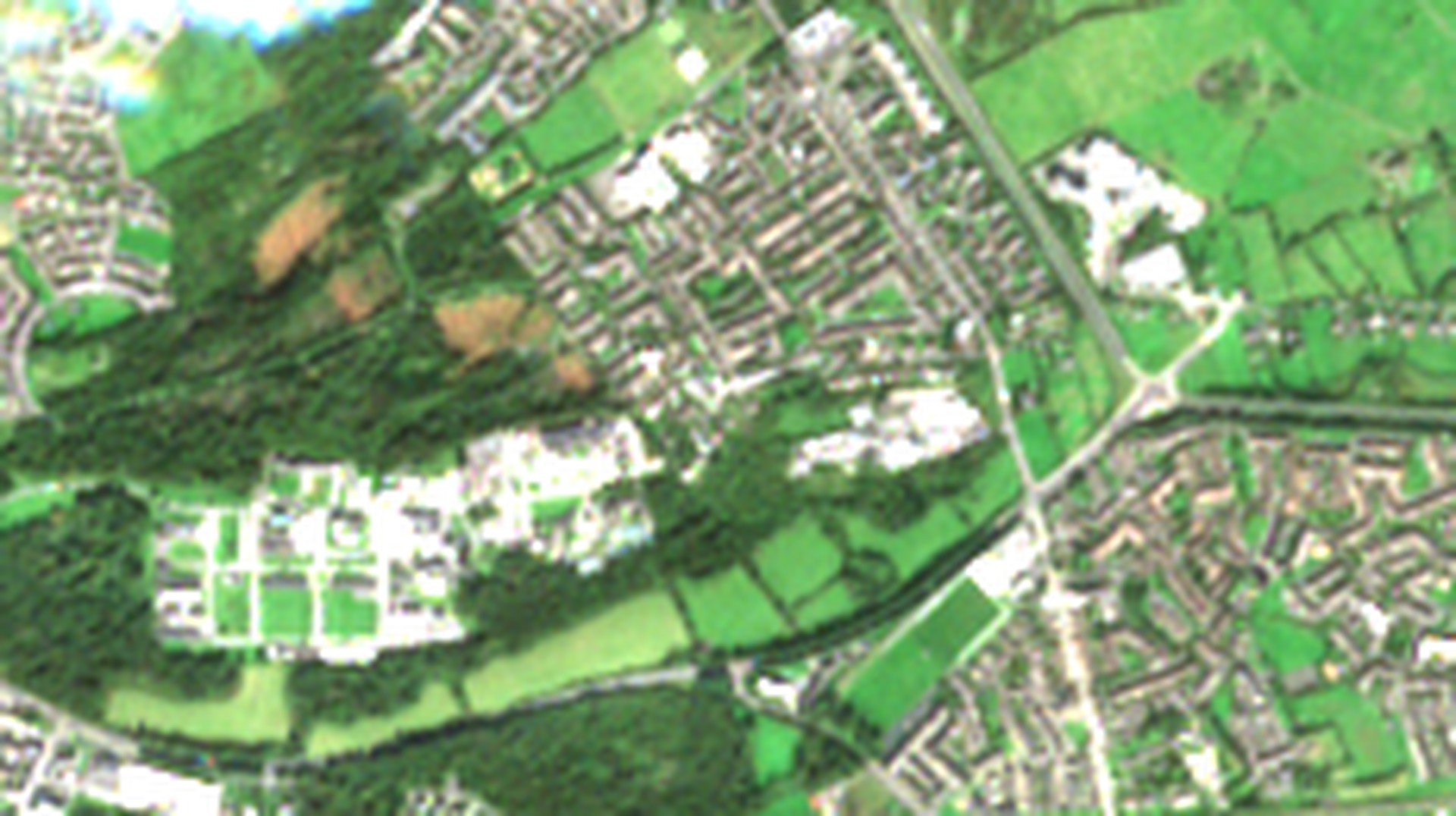
Felled patches
Sentinel-2 and Sentinel-1 · March to October 2026
Merlin Woods from orbit
What optical and radar satellites show of the conifer clearance in Doughiska, Galway
Contains modified Copernicus Sentinel data 2026
1 / 13
Felled patches
Sentinel-2 and Sentinel-1 · March to October 2026
What optical and radar satellites show of the conifer clearance in Doughiska, Galway
Contains modified Copernicus Sentinel data 2026
1 / 13
The story so far
1
2
3
4
5
Mar
Apr
May
Jun
Jul
Aug
Sep
Oct
2025
Sentinel-2
26 Sep: latest clear pass
solid = clear, hollow = partly cloudy; shaded = felling works
no clear optical scene
1 · Jan 2025
Storm Eowyn damages the Norway spruce, about half the woodland
2 · 8 Jul
Council announces a restoration plan and seeks NeighbourWood funding
3 · 26 Aug
Plan published: fell and replant 3.5 ha; 54% of the woodland kept
4 · 9 Sep
Clearance works begin; squirrel feeders go in
5 · 17 Sep
Friends of Merlin Woods call for a pause
Sources: see final slide
2 / 13
Where it is
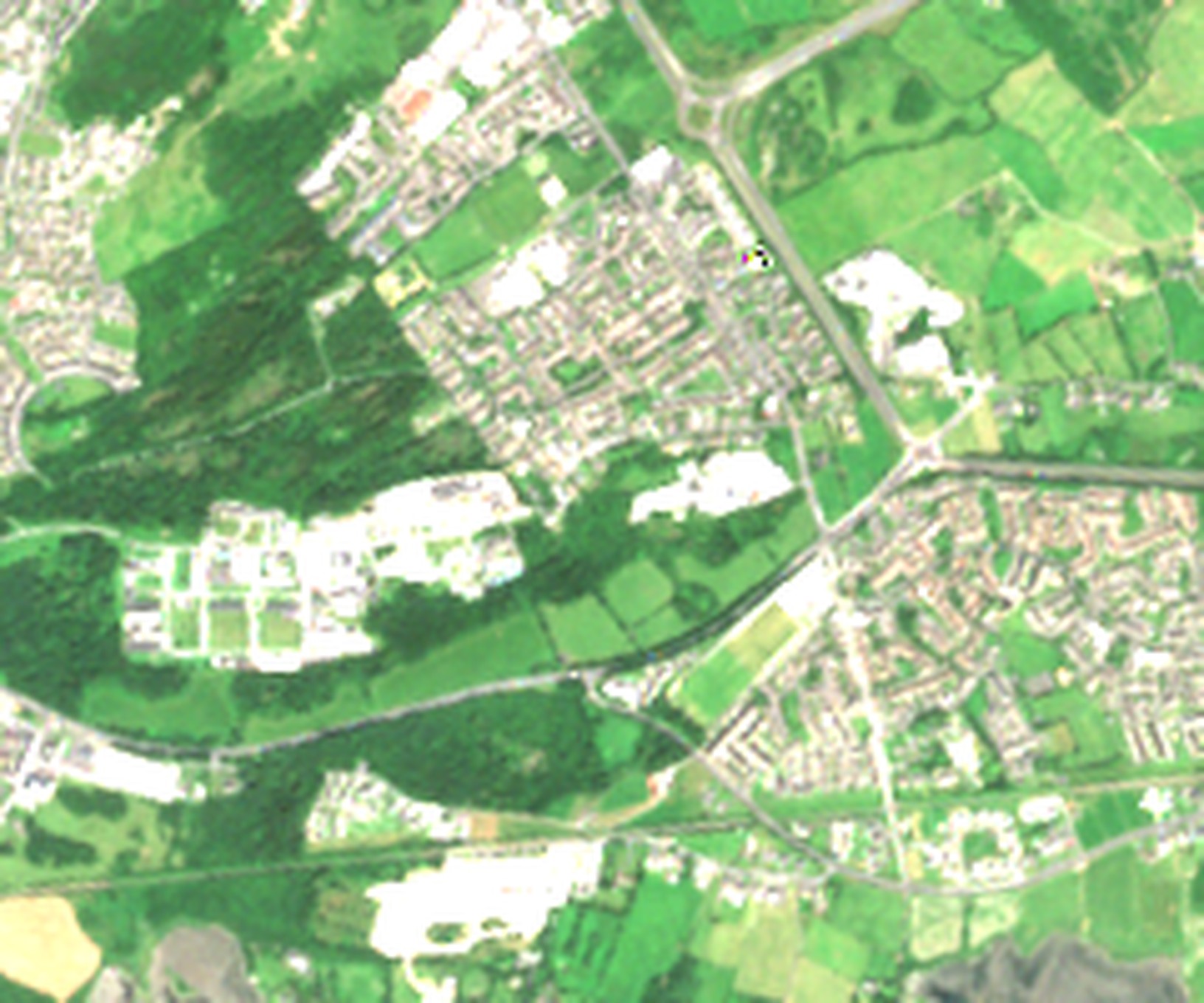
Merlin Woods
Merlin Park Hospital
Doughiska
Railway to Dublin
Detail on next slides
58.5 ha
mapped as Merlin Woods in OpenStreetMap
46.5 ha
of tree canopy inside that outline, measured from the imagery. The western 5.7 ha lies just off this satellite tile
8%
of that canopy is the 3.5 ha the council plans to fell, so the reported “46% of the wooded area” must refer to a smaller area
Outline © OpenStreetMap contributors (ODbL) · imagery 13 July 2026
3 / 13
Before and during felling
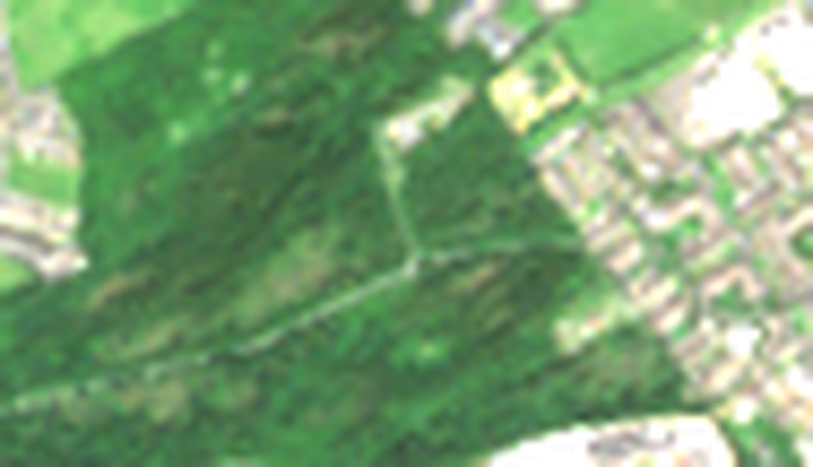
13 July
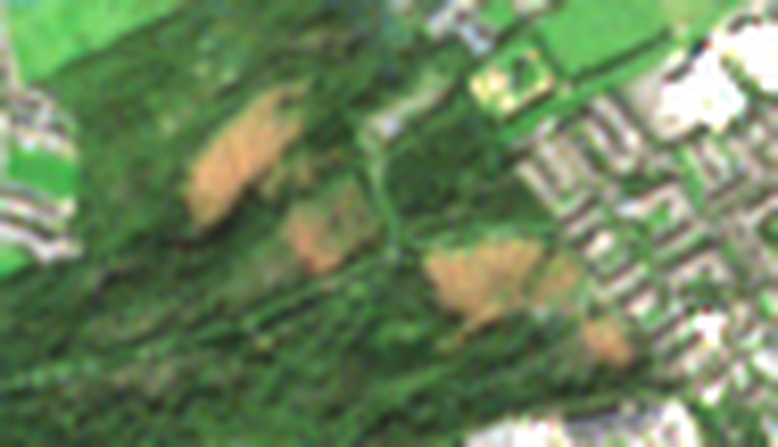
26 September
Unbroken dark-green conifer canopy before the works.
Brown bare ground where stands have been felled, with works still under way.
S2C vs S2A, orbits R123 / R023
4 / 13
Every clear view
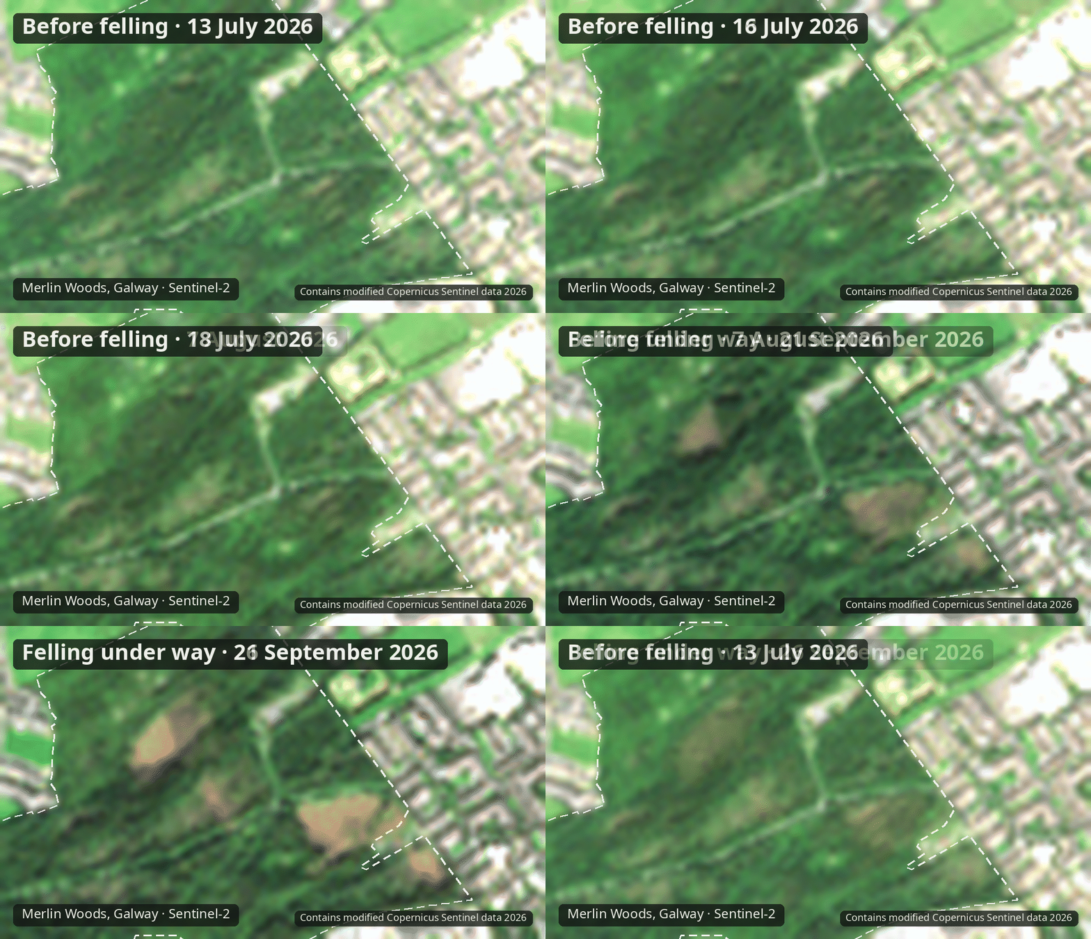
13 July · before
16 July · before
18 July · before
7 August · before
21 September · felling under way
26 September · felling under way
Only scenes with at least 95% of the wood cloud-free are shown; cloudy passes are skipped.
Sentinel-2 true colour, same colour stretch in every frame
5 / 13
Where the canopy went
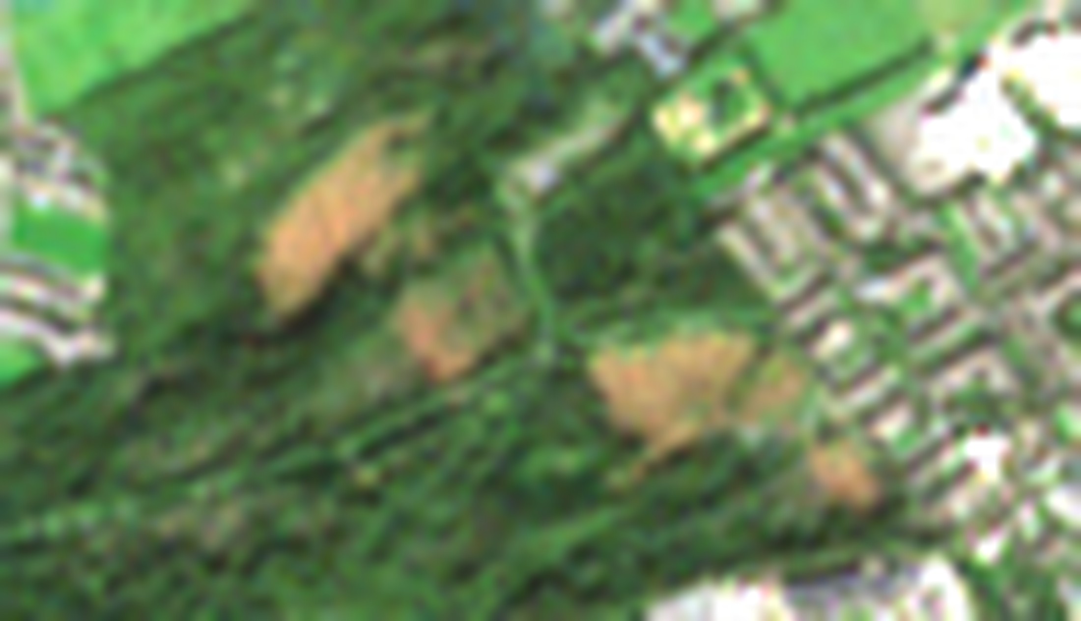
B
A
F
C
D
| Patch | Hectares | Greenness change |
|---|---|---|
| B | 1.01 | −0.21 |
| A | 0.75 | −0.18 |
| F | 0.28 | −0.17 |
| C | 0.12 | −0.19 |
| D | 0.06 | −0.23 |
| Total | 2.22 |
Greenness change is the drop in NDVI from the June–July baseline to 26 September, after removing the wood-wide seasonal shift.
Detection: NDVI and moisture index both fall; 10 m pixels
6 / 13
Progress by 26 September
2.22 ha
felled of the 3.5 ha planned (63%)
range 1.22–3.34 ha across detection thresholds
0 ha
2.22 ha felled
3.5 ha planned
By clear pass: 21 Sep 1.24 ha · 26 Sep 2.22 ha
Plan figure: Galway Daily, 26 August 2026
7 / 13
The signal over time
Greenness (NDVI)
0.5
0.7
0.9
Mar
May
Jul
Sep
0.38
felled patches
0.47
rest of canopy
In March, before leaf-out, these stands were greener than the rest of the wood: the mark of evergreen conifer.
Canopy moisture (NDMI)
0.0
0.2
0.4
Mar
May
Jul
Sep
0.30
felled patches
0.39
rest of canopy
Felled patches (2.22 ha)
Rest of the canopy (44.3 ha)
Felling under way (from 9 Sep)
Median per group, clear passes only; each dot is one satellite pass
8 / 13
Sentinel-1 radar · a pass every two days
−2
−1
0
+1
+2
Jun
Jul
Aug
Sep
Oct
Sentinel-2
normal pass-to-pass range
+1.0 dB
on 8 Oct
felling under way
Felled patches minus intact canopy, dB (one dot per pass; line = 3-pass mean)
±2 sd, June–August
Sentinel-1 GRD, VV and VH averaged, three orbits, each normalised to its own June–August baseline
9 / 13
What the radar adds
COVERAGE
Three Sentinel-1 orbits cover the wood; since July a usable pass has come every 2 days, filling the optical gap from 7 August to 21 September.
2 days
median gap between passes
SIGNAL
Freshly felled stems, brash and newly exposed forest edges scatter radar strongly. A drop usually follows only once the site is cleared.
+1.0 dB
felled patches, 8 October
CHECK
The 5 October pass came after 0.3 mm of rain in 12 hours. The wettest pre-works pass (3 August, 7.3 mm) is at -1.1 sd.
0.3 mm
rain in the 12 h before 5 Oct
Rainfall: Open-Meteo modelled hourly precipitation for the wood
10 / 13
Method
STEP 1
Inside the Merlin Woods outline, keep pixels that are dark in near-infrared in March (not grass) and green all summer.
46.5 ha
canopy observed
STEP 2
Median of four clear June–July passes against 26 September. Greenness and moisture must both fall, after removing the wood-wide seasonal shift.
4 → 1
clear passes compared
STEP 3
Run the same test on two July passes, before any works. Drop specks under 4 pixels and hedgerow slivers beside mown fields.
0.00 ha
flagged by the no-works control
Sentinel-2 L2A surface reflectance · 10 m bands B04, B08; 20 m B11
11 / 13
Caveats
10 m pixels.
Small openings along paths, and single trees, are below what this can resolve reliably. The smallest patch here is 6 pixels.
Two clear optical passes since works began.
Felled trees left lying, or brash, can still read partly green, so the area may be undercounted. Later passes firm it up.
No clear optical scene from 7 August to 21 September.
Radar passes every two days fill the gaps, but radar alone cannot map patches this small.
Species are inferred, not seen.
Conifer is read from winter greenness; the satellite does not identify Norway spruce directly.
Storm damage predates the imagery.
Any openings left by Storm Eowyn in January 2025 were already there in March 2026, so they sit in the baseline and are not counted.
Merlin Woods from orbit
12 / 13
Sources
Galway Bay FM, 8 Jul 2026
City Council begins plans for removal of fallen trees in Merlin Woods
Galway Daily, 26 Aug 2026
Plans to restore Merlin Woods with native trees
Galway Bay FM, 28 Aug 2026
City Council facing criticism for Merlin Woods felling plan
Galway Bay FM, 9 Sep 2026
Squirrel feeders being installed in Merlin Woods as clearance works underway
RTÉ News, 17 Sep 2026
Call to pause Merlin Woods felling over ecosystem impact
Imagery
Contains modified Copernicus Sentinel data 2026. Sentinel-2 Level-2A, tile T29UNV; Sentinel-1 IW GRD, orbits 23, 74 and 96.
Woodland outline
© OpenStreetMap contributors, ODbL. Relation 14174436, “Merlin Woods”.
Analysis
Python with GDAL and NumPy. Rainfall: Open-Meteo. Thresholds and controls are in the speaker notes.
Merlin Woods from orbit
13 / 13